Beverly and I sat patiently for 3 hours or so in the FBO Lobby in Easton, MD (KESN). We ate our packed lunch, talk with a nice couple who was touring the area by car, and waited for the weather to improve.
Just after noon I felt that the temperature had increased enough, and that the cloud cover had broken somewhat. It actually looked like it was clearing to the west of us, just as the Airmet Zulu was at the end of it’s forecast period.
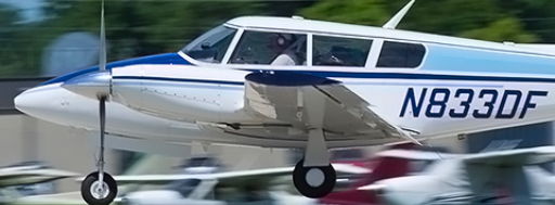
We made a rest room stop, packed up our gear, and lifted off for Punta Gorda once again. Our flight plan was to include a stop at KCKI, Williamsburg, SC (Kingstree, SC). I fully expected to fly for 30 minutes until clear of the ZULU, and then skirt around clouds and light rain as needed all the way south. The flight plan started out at 4,000′; well below the overcast and presumably clear of whatever ice remained. If we could get to COLIN intersection, I figured we’d be home free.
The plan appeared to work out fine, as we made it clear of the ZULU airmet and climbed to 6,000′ in the clear. Continuing south of Norfolk, the clouds closed in at our altitude. Icing was reported as light (unexpected and unforecast), so we asked for 8,000′ and climbed up and over. The overcast layer didn’t go all the way to the ground, so I felt I could get down through it if the need arose. Beverly and I went on Oxygen.
Headwinds all the way, but manageable.
Further south, the clouds kept rising, but the overcast layer rose as well. We asked for and climbed to 10,000′ in the hopes that we’d get beyond all this weather and be home free to the south. After about another 15 minutes of flying, it was obvious we couldn’t continue at this altitude without flying into clouds and ice. Helpful reports were coming in that there was no icing at 13,000′, but I was disinclined to make that effort. I had been wrong about the weather all day, and the ice wasn’t even supposed to be in this area.
I asked the controller if he had any reports on 6,000′ in this area. He had no PIREPs, but the overcast level coming in on XM and FIS-B gave me hope that I might find clear air for the continued run south. I discussed it with him and then decided to descend back to 6,000′ and see what I had there. Before starting down, the controller assured me that I could continue down to 4,000′ if need be.
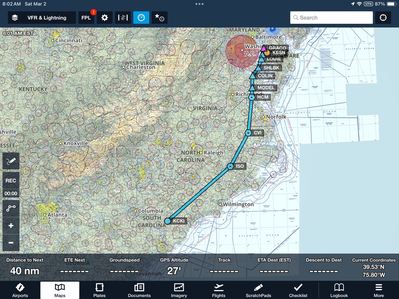
Leveling off at 6,000′ there was enough of a cloud layer that I might start picking up ice again. I requested 4,000′ and started down. We were in the Kingston, NC area by this time. Reaching 4,000′ I was most certainly clear of the clouds. The wind had shifted, however, and were variable and stronger. You can see in the image below how variable my ground speeds became, but you’d have to be there to experience the turbulence.

Continuous Moderate Chop is defined as Turbulence similar to Light Chop but of greater intensity. It causes rapid bumps or jolts without appreciable changes in aircraft altitude or attitude. Totally a pain in the ass.
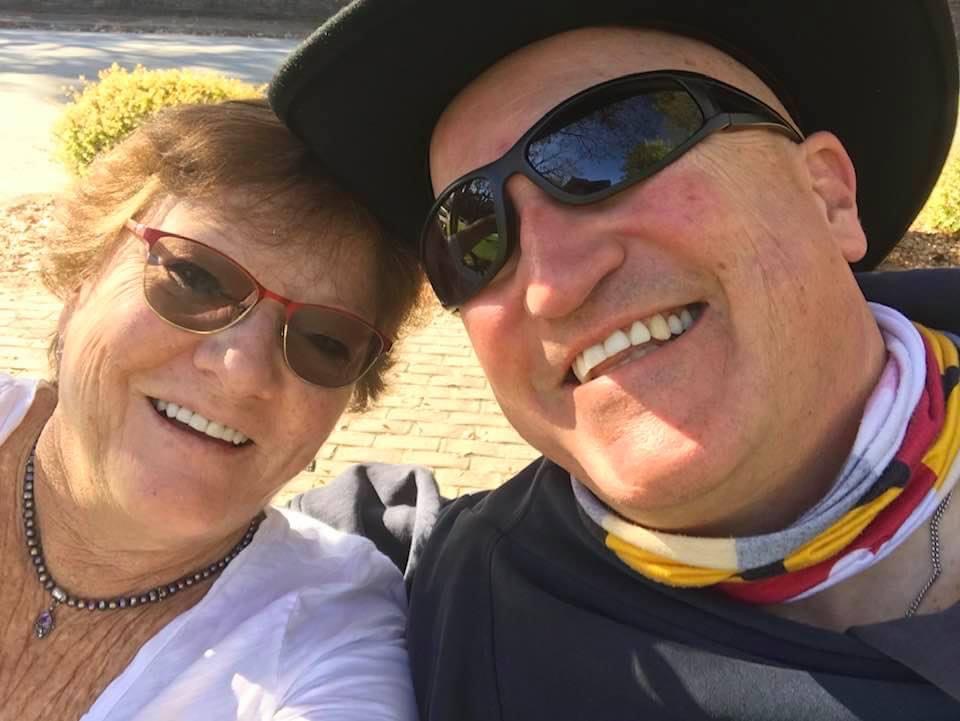
Beverly tolerated it quietly and with a smile. She was a significant safety factor during this entire day, adding absolutely zero to my workload and completely supporting the effort.
Up ahead there were vails of percipitation. They appeared to be light rain; somewhat thin; and almost a light brown or shadowy color. There were actually three lines of precipitation we’d have to penetrate, and I chose to deviate to the thinnest parts of each line as we proceeded south toward our fuel stop. Winds were building and our groundspeed took a hit.
The first line turned out to be SNIRGA – snow that was falling, but not making it to the ground. There was icing above, but the snow wouldn’t affect my airframe. The next line was rain, but we found a hole to sneak through and stay dry.
By this time we were closing in on KCKI, Williamsburg. The small rain cell had now grown into an ugly storm just south of the field. The moderate turbulence continued unabated, as did the bumps, wind, ice, snow, and rain. I gave up on this fuel stop and decided to divert to KIIY, Washington/Wilkes County, GA. I picked this at random because it would get me well clear of the storms to the west, where we’d have a clear shot for the final push to Punta Gorda. Storms to 25,000′ in the south – in February.
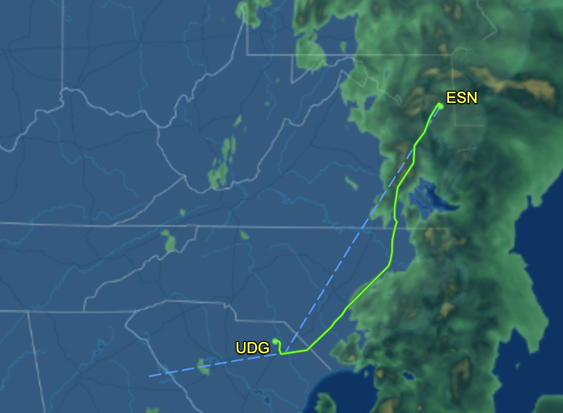
The image below shows how much we had deviated all the way south, the diversion target of KIIY, and finally the airport we landed at in Darlington, SC (KUDG).
After deciding that KCKI wouldn’t work, and while continuing to get our butts kicked in bumps down at 4,000′, I deviated well west of all the weather. When I turned, however, my ground speed dropped to 130kts!!. That was down about 30kts prior to the turn. What that meant was another hour of getting our teeth rattled, before we could even start on the next leg.
I’d had enough and told the controller so. He offered to land me at KFLO, Florence, SC right away, but I declined. I was thinking that this airport might be prohibitively expensive, and I might be better at a lesser used facility. I saw Darlington in the clear and off my right wing, so we landed there. I was tired and it showed. Time to stop flying before the fatigue and the weather built up to unsafe levels.
I sent Beverly inside as I fueled the airplane. Storms were now closing in on this field and looked short, but ominous. These were no summer thunderstorms, but I finished fueling and quickly moved the airplane to a tie-down. I’d decided there’d be no more flying today, and Beverly had independently decided the same thing.
We found a room and a taxi to get us there, after just a little trepidation. Had a nice meal in the nice little town of Hartsville, SC.
Don’t underestimate the value of your co-pilot
Beverly made this trip safer from start to finish. Her continuous calm demeanor, willingness to sleep in the FBO if need be – rather than fly on, and supportive attitude improved this pilots performance and decision making. We had an adventure and an enjoyable evening together, after a teeth rattling flight south.