
I just got back from an amazing Cheyenne flight this Friday, and I’m still high on it as I write this on Sunday morning. Bare with me as I lead up to our flight home, which is why I’m still so very pumped. There is a certain euphoria that I get when a well planned flight is completed professionally.
Getting Ready: We left on Tuesday, just after a strong snow storm left heavy wet snow at our hangar door. Studying the forecast on the days leading up to the trip on the 24th showed the systems moving out, so all we needed was for Atlantic Aviation and DRBA to clear a path to the runway for us. They did that for us, with a little help from our own snow-blower, and we were ready to go out early on the 24th. The ramp, taxiways, and runway 27 had all been cleared for us.
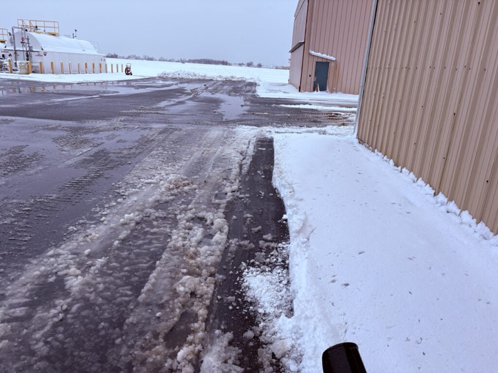
Winter flying requires preparation: I prepared for this trip by snow blowing my hangar and the company hangar after a heavy wet snow on the night of the Feb 22nd.
February 24th: The departure was no big deal. We departed with a 17 kt gusting crosswind and moderate chop, but climbed out of it in VFR conditions. The situation only got better as we closed in on our fuel stop in Charleston, SC. From there we flew down to Miami Opa-Locka airport, where we’d stay until our planned Friday return home.
Staying in Hialeah, Florida: I hadn’t flown a passenger trip since last October with all the work we’d had done on the airplane. The trip was also not certain due to weather, as they were calling for a blizzard the day before we left. The previous February storm had left runways closed for weeks, and the airport in this storm was already closed for two days before it even got there. I saw all this and delayed packing and reserving crew rooms until the last minute.
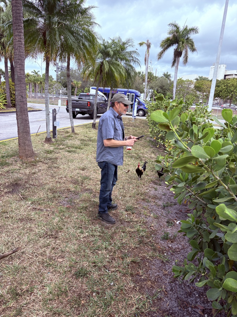
Hialeah: I chose a hotel near the airport, and ended up in Hialeah. Chickens roam freely and the roosters crow constantly in Hialeah. Jeff likes to feed them his leftovers from dinner. He talks to them too……
The hotel we ended up in was clean but worn. Likewise the entire area. We were staying in a Cuban neighborhood, from the sound of it. Most of our UBER drivers and servers did not speak any english, and neither of us spoke any spanish. We managed just fine, however, and met some really interesting people. The only downside to my hotel selection was the lack of nearby restaurants, and the intense traffic in an area this close to the airport.
We used UBER for everything, and I must say that the cost was entirely reasonable. all of the drivers were entertaining and polite. I’m a novice UBER user, but it worked smoothly. Language was not an issue.
Planning the fun part: Now I get to talk about the big fun I had coming home. My days in Miami were spent planning and scheduling upcoming trips and doing paperwork. All the while I was watching weather and discussing flight planning strategies with my copilot Jeff. This is the fun part, preparing to do battle with the weather.
I knew early on that a thunderstorm line might block our path north along the Florida border. In addition to that, there was a wide area of ICE to get through that would add to the excitement. Complicating our planning further was the fact that Low IFR or Very Low IFR would exist over a wide area along our flight path, limiting our emergency choices for landing.
The Cheyenne is a capable machine, and definitely could do this flight. The devil was in the details. I chose Norfolk as our fuel stop after a planned 3 hour flight. That would get us out of all the weather and present me with an easy approach in marginal VFR by the time we arrived. This plan, however, would only work if I didn’t have to use engine anti-ice; if the winds were favorable; and if the fuel burn was as planned. Engine anti-ice protects the blades from erosion, but robs power and range at the same time.
I planned to optimize our chances for getting to Norfolk by climbing above the weather if I could. The caveat there was that there was moderate icing in the forecast, and there I was uncertain that I could out-climb it. Furthermore, icing tends to worsen at the top of the rain clouds. Were I to encounter severe icing, I’d then have to descend through 20,000′ of additional ice looking for salvation.
Another consideration was an engine failure up high. That would leave me with descending single engine down into the ice, with low clouds and few options over a wide area down low. Its all about the risk management, and the decision making would be dynamic today.
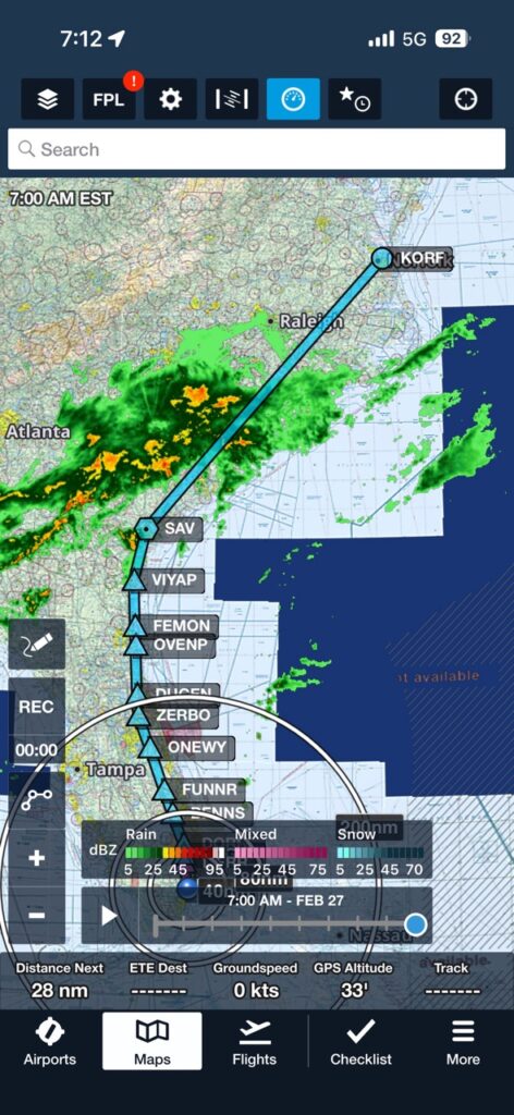
Executing the Plan: I decided to file for FL190 (19,000′) on the first leg coming home. We’d have an hour before entering the weather around Savannah, and possibly be able to gauge where the tops actually were before we got there.
We’d monitor ice and the ceilings in the area below continuously, and identify escape routes and emergency approaches at each stage of the flight.
Flying approaches to minimums was not a concern for me, so long as I made my decisions early enough to be FAT on fuel if the need arose to divert.
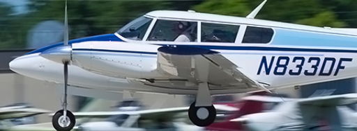
The Actual Experience: I had planned for a gross weight take-off. The maximum weight we were allowed to take-off and land with based on weight of people and fuel. I ordered the nacelle tanks full, with an additional 8 gal in the tips to reach max takeoff weight.
It takes awhile to fuel the Cheyenne, and if you aren’t patient, what looks like full tanks will settle out and actually be less. From the gauges at startup, I believe we did not get all of the fuel we could have carried.
Secondly, we encountered IMC and ice earlier than I anticipated. We’d be using engine anti-ice protection longer, robbing us of power and range to some degree.
Diversion: The moment we leveled off in cruise, I began to recalculate our potential range. FAA IFR fuel requirements (14 CFR 91.167) require carrying enough fuel to fly to the first airport of intended landing, fly from that airport to the alternate (if required), and fly after that for 45 minutes at normal cruising speed. An alternate is required if weather is below 2,000 ft ceiling/3 SM visibility 1 hr before/after.
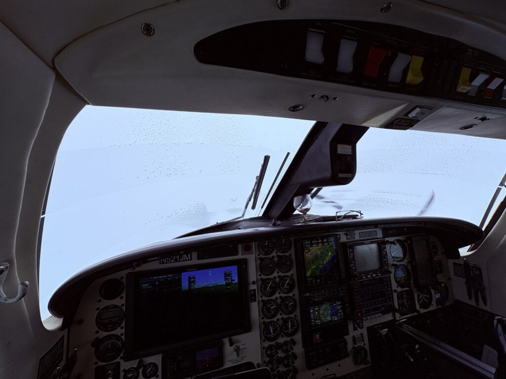
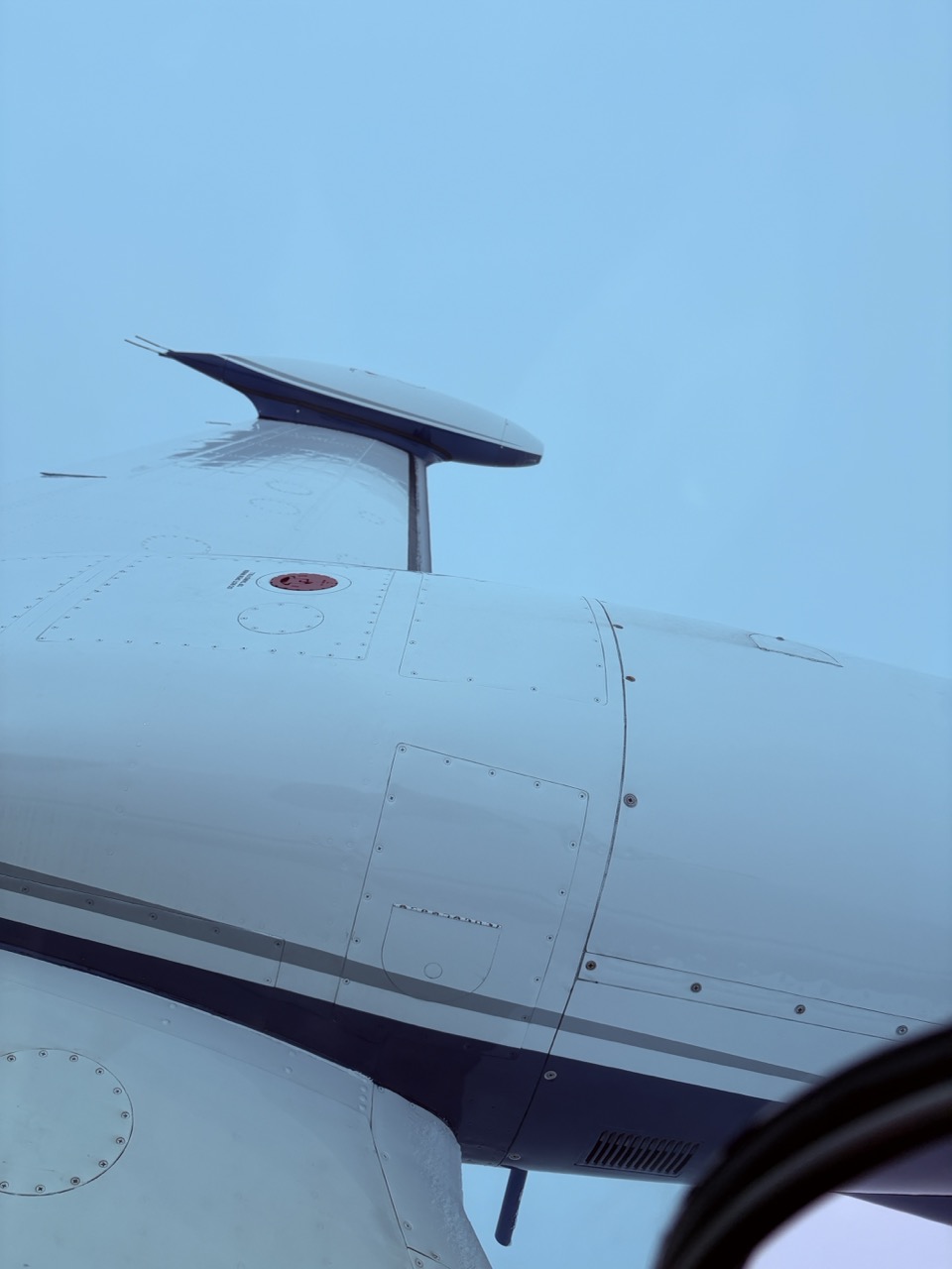
Ice on the windshield
Windshield heat: On LOW
Engine Anti-Ice: ON
Pitot Heats: ON
Surface De-Ice: as needed
Re-evaluating our Norfolk plan, I decided early to abort the original plan and go with my alternate. Jeff and I now planned to land at Savannah for fuel and a break, just south of the heaviest weather. We’d have plenty of fuel for several approach attempts there, and also for a diversion back to the south if necessary.
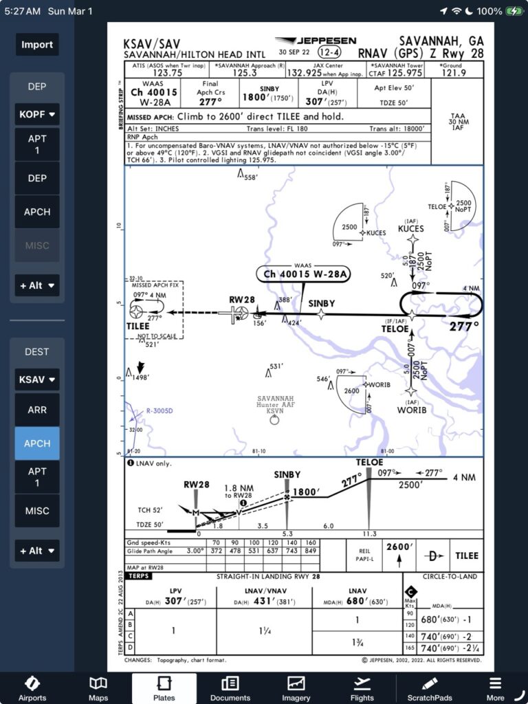
Setting up for the Savannah Approach: I was cleared direct to WORIB on the chart at left, for the RNAV 28 into Savannah. This approach kept us clear of the heaviest weather until we turned west on the final approach course. It would be bumpy, but we could get it done. Jeff called ahead to the FBO to let them know we’d be coming in, and ensure they had fuel.
Life was good. We’d fly an approach and break out above minimums – easy peasy.
Approaching WORIB, the radio chatter started picking up with the flight ahead of us. We began hearing that the rain on the way in was moderate and building, and that significant cells were within a mile of the departure end of the runway. The clouds ahead were getting darker and the rain was building, confirming what I was hearing. It would be a rough ride going in, and really bad if we were to miss the approach and try again. This was still doable, but we could be flying right into the worst of it.
Last Minute Diversion – again: If there were no other options, I felt it was safe to continue the approach. There actually were two options available, however, that would reduce our overall flight risk and improve the passenger experience.
I could reverse course and fly back to Brunswick right now. I could also alter course, fly along the storm line, and do an approach into Hilton Head (KHXD) toward the south.
Weather was converging on Hilton Head as we flew. If the weather got bad all of the sudden and/or we missed that approach, I would then continue south to Brunswick and land there. Solid plan.
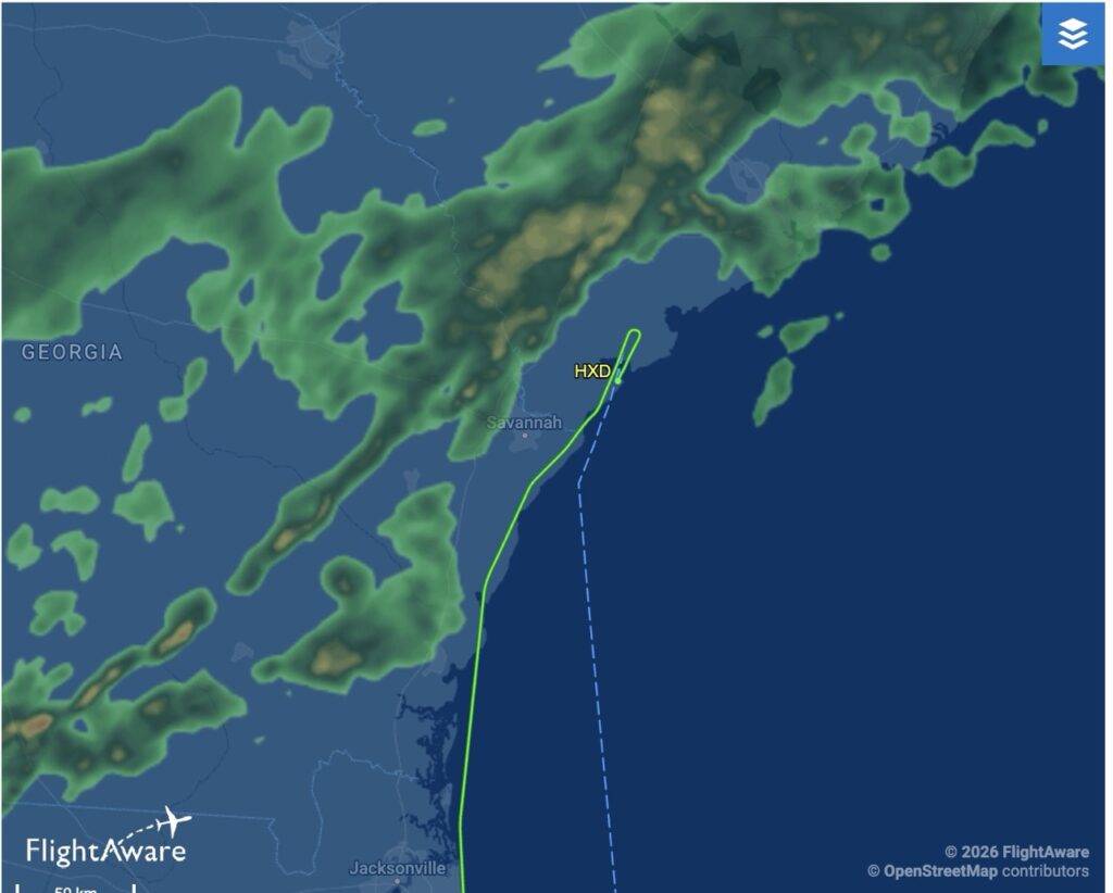
Diverting to Hilton Head was definitely the better choice. We had practiced rapid diversions just prior to this trip, and I used those skills to work with ATC; brief the new approach; and rapidly reconfigure the avionics accordingly. Our execution was flawless, but there was a jet departing Hilton Head that delayed our approach somewhat and led us into the edge of the storm. We did get a bit wet, but we were turned before it got rough and completed our approach to landing.
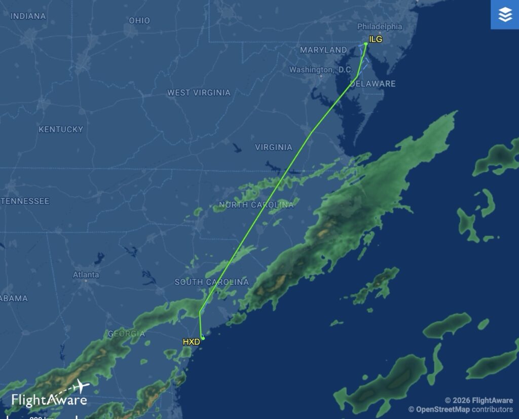
After a short break and refueling, we filed a new flight plan for the second leg to home. You can see that we found a convenient gap between two bands of weather, and flew direct north for awhile.
Climbing to 15,000′, Jeff saw a weather opportunity and suggested we ask for a turn to Richmond. We did that and flew through more light Rime Ice and light chop heading northeast. Working together, and with ATC, we had an uneventful fight home.
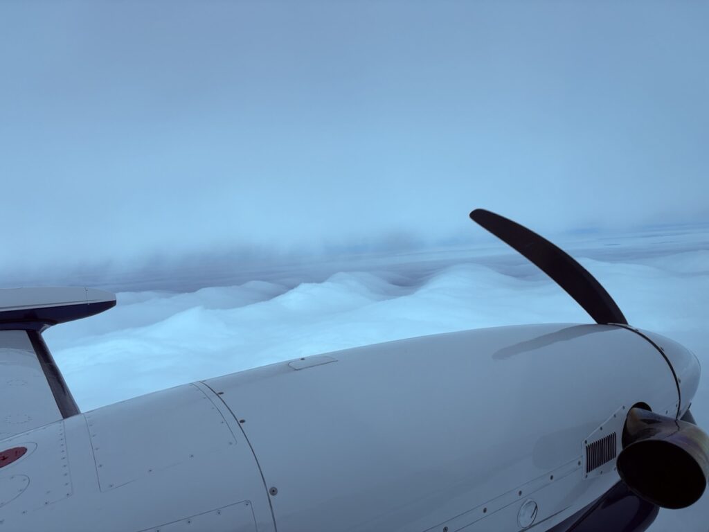
Cloud formations reflecting the terrain below.
I hope I have managed to convey how cool this all was. The plan that Jeff and I worked on came together and left us with numerable safe alternatives all along the route. I was able to log an actual approach in weather and gain more experience managing ICE. It was exciting and thrilling to be able to do this flight safely.
Thanks for reading this and allow me to share the joy I felt in doing this job. Thanking God for the skills of my instructors and friends, and for the opportunities I’ve been given to help keep people safe in pursuing their passions.
Fly Safe!
Frank