
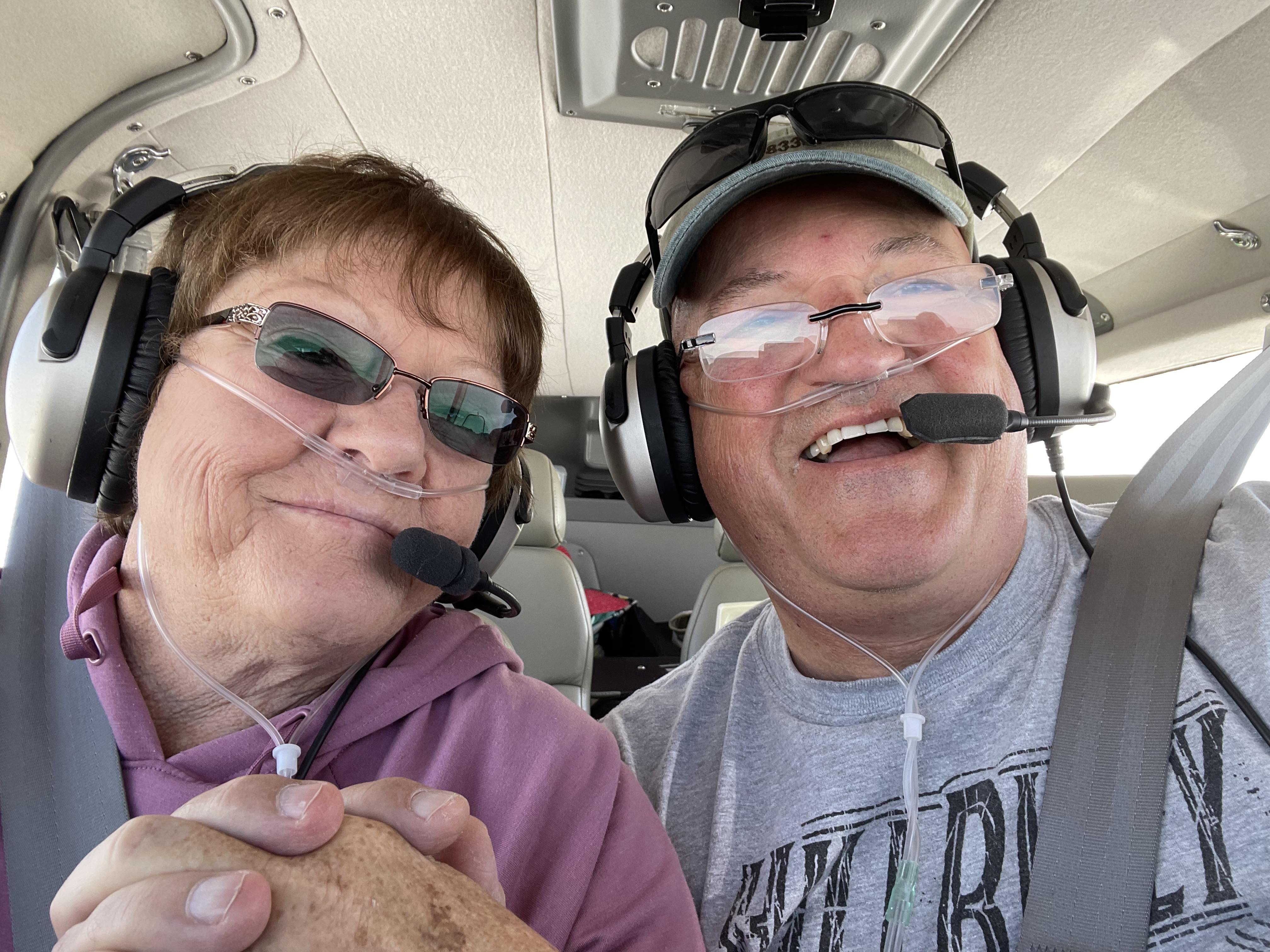
Bev and I are both retired now. I’m still doing contract flights in the G280 now and again, but for the most part we are doing short trips around the country with the Harley or the Twin Comanche as we see fit. This particular trip was an awful lot of fun, so I thought I’d take a few minutes and memorialize it.
Bev and I kind of invited ourselves on a vacation with our daughter and son-in-law; Scot and Leigh Ann. They were planning to drive two of their boys and another cousin south to Biloxi, where they planned to spend time with Scot’s brother Jeff’s family. We’d fly down and hang out with everyone for a few days in the middle.
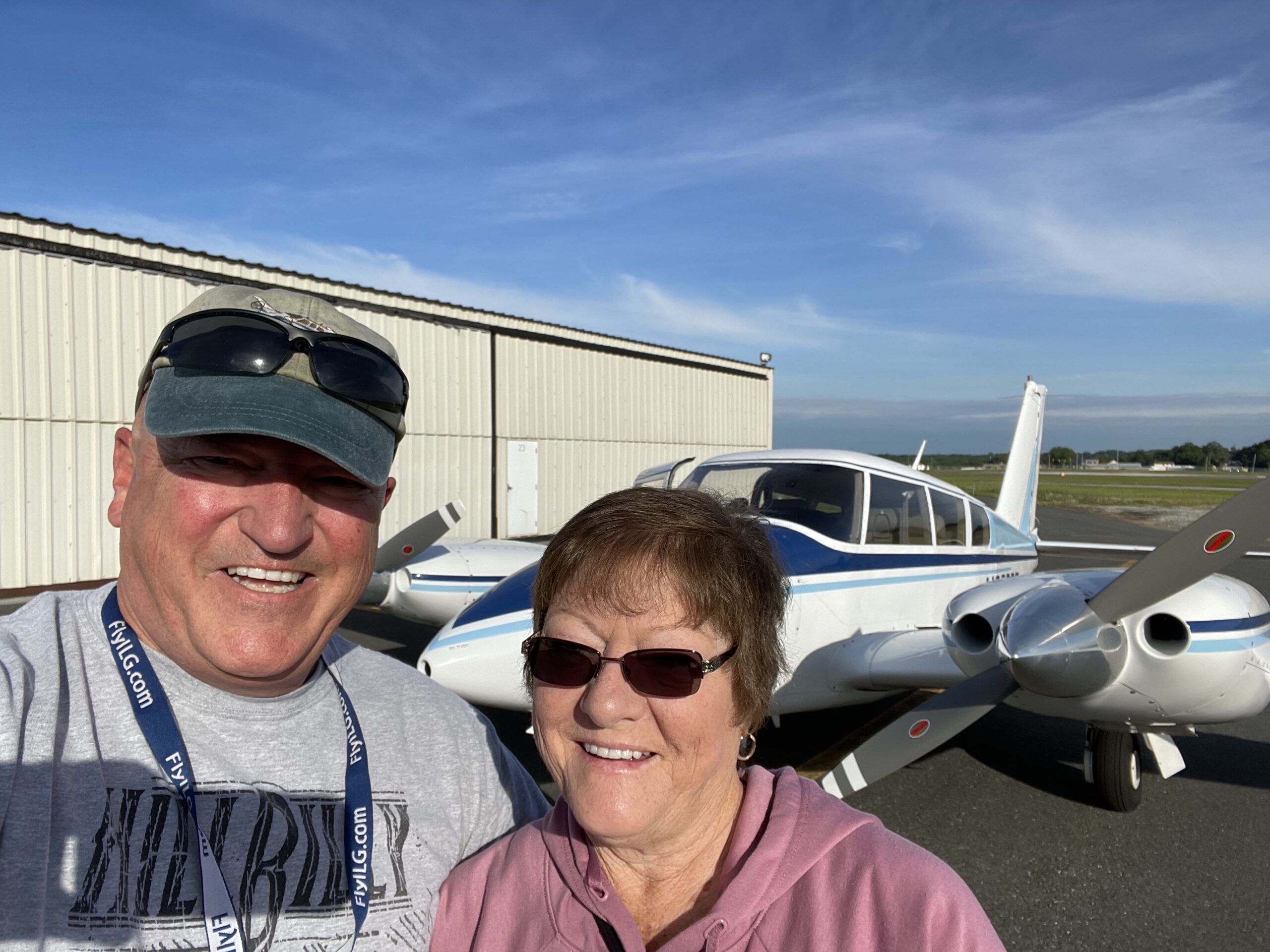
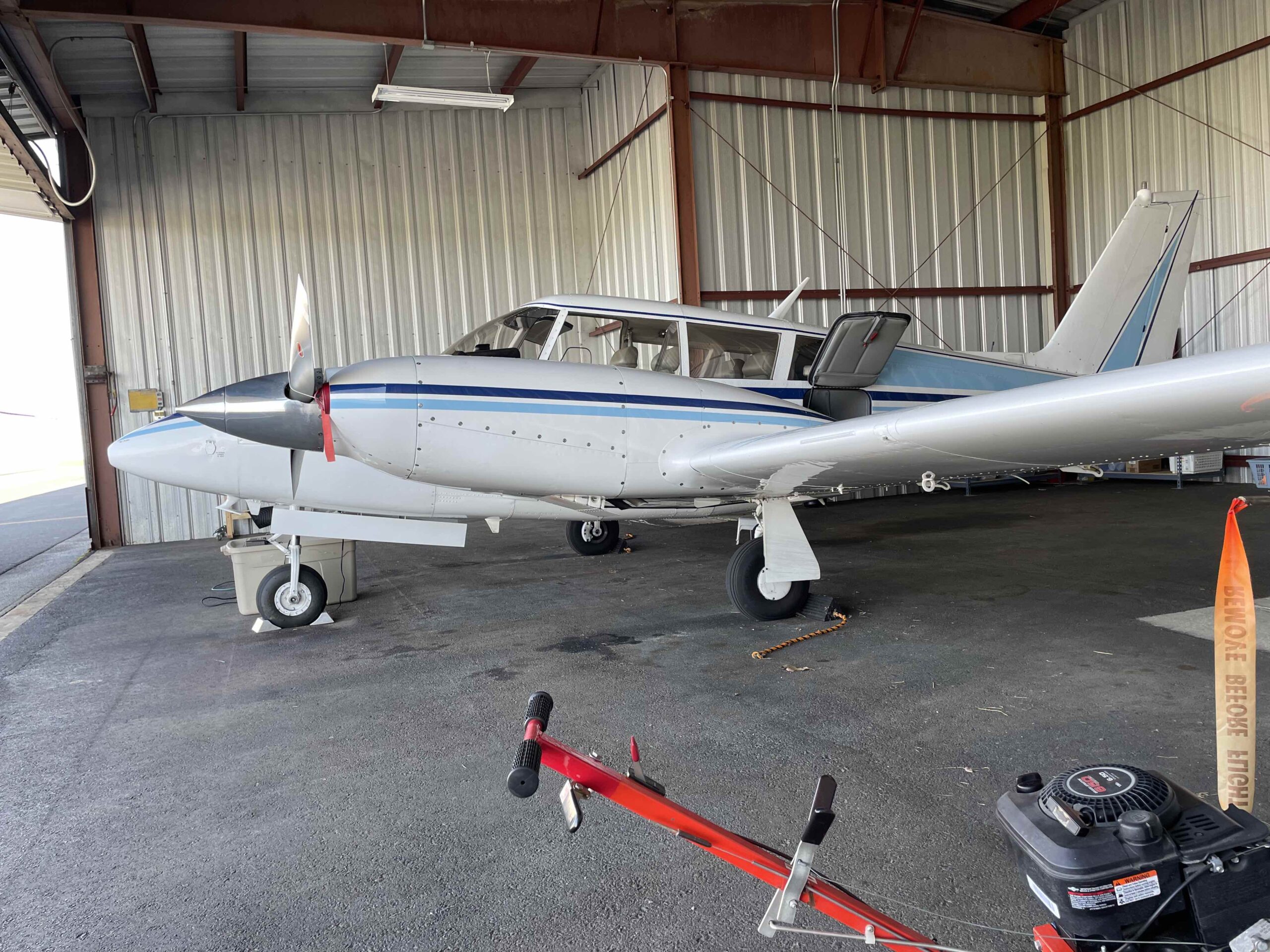
Getting the trip started: Bev and I flew our Twin Comanche – N833DF – on the first leg from KILG (Wilmington, DE) down to KAJR (Cornelia, GA) airport. Bev and I both have been struggling with cold type illnesses for several weeks, but we recovered enough to make this flight. We were off the ground by 8:10am and passing north of DC westbound at 10,000′ by 8:30am. That is when the first of two mission glitches popped up.
Dead Reckoning in the DC Area: Approaching MRB (Martin State VOR), the IFD550 navigator went into Dead Reckoning mode. I continued the flight using the uncertified Garmin 496 and the autopilot heading mode while I looked into what was going on. The GPS status page showed that no satellites were being received. I was concerned by my proximity to the DC airspace; annoyed that I might have to scrap my direct to routing for the more arcane VOR-TO-VOR routes; and really annoyed that the unit was new and giving me grief.
I powered off the IFD550 OFF and then back ON. It works for windows, so maybe the ship will right itself when I do that. As soon as the unit powered up, the satellites were received, SBAS worked, and navigation was once again available. I continued the flight down with no further issues. I’ll follow up with Avidyne after we land for the day.
Note that I did report the outage to the controller, but only AFTER I’d resolved the issue. I didn’t need to be vectoring and communicating while navigating old school and diagnosing electronics. I wanted to let him know in case the military had caused the outage, or others might experience the same thing (external causes). This controller and the next controller both asked several times if I was still ok as the flight progressed.
Lightspeed Zulu: With the IFD550 issue resolved, now my reliable Lightspeed Zulu headset developed a dead battery. The ANR feature dropped off, making the headset quite useless. I changed the batteries to known fresh ones to get the headset working again, which is not unusual. What was odd, however, is that the red low battery indicator stayed on, indicating that the batteries were inadequate and the unit would fail again. I changed the batteries to yet another set, even though I’d tested all of these batteries, but the red light stayed. Son of a B#@!h!.
At Bev’s suggestion, we switched headsets to avoid my having to deal with the IFD550 issue (should that resurface) with a failing headset. I did have one of the David Clark units in the back seat as a fall back, so I wasn’t concerned. I’ll deal with this after we land as well. I have since decided to put both of the spare David Clark’s in the airplane all of the time now, to be ready in case kids wanted to fly back with us on some future flight.
Landing at KAJR (Cornelia, GA) to get fuel, where we met Bob. This gentleman was working the FBO today as a side activity. It seems that Bob works in R&D for industrial glass blowing for a local company; he absolutely loves the area and is glad he is back there; and really glad he didn’t stay in New Jersey to work in a glass blowing factory. Bob is an amazing ambassador for this Georgia community, and tried to convince us to decide to live here!
Neither Bev nor I need to be sold on the Peach State – we’ve had some great times with great friends here. The FBO was clean and refueling was a non-event. I picked up our clearance by phone, and we were soon climbing away for our destination – KPQL (Pascagoula, MS).
Final leg south: Reaching 10,000′, Bev pulled out our packed lunch and we enjoyed a Jersey Mike’s sub at altitude. The final leg would be less than 2.5 hours, and I very much enjoy passing the time with a good lunch in the cool temperatures at 10,000′. Life is good and this is fun.
It is worth nothing that the airplane, aside of the Avidyne issue, was performing flawlessly. I’ve had some trouble syncing props right away in the past, but not today. Smooth engines; perfect syncing; impressive ground speeds; and an autopilot that was built in 1966 and is working perfectly. I don’t always fly a perfect airplane, but when I do, it’s because I’ve spent a fortune and think it was worth it.
Approaching Pascagoula: I had chosen this airport because it has two approaches; a nice long runway; and there was hangar space available at a very reasonable cost. There is another airport of adequate length within just a few minutes of my destination, but I prefer driving 30 minutes for the added features of this one. If the weather is down low on the way home, I want to be able to get a clearance quickly and efficiently out of there. There also have emergency equipment and services, whereas the local airport did not.
Sirius XM weather is most definitely better than FIS-B weather. I had recently canceled my subscription and saved some $700+ per year in doing so. I did miss it today, however, as the FIS-B regional radar wasn’t reliably updating enough to get a clear picture of the storms brewing at my destination. I had to supplement what I saw with the controller’s knowledge.
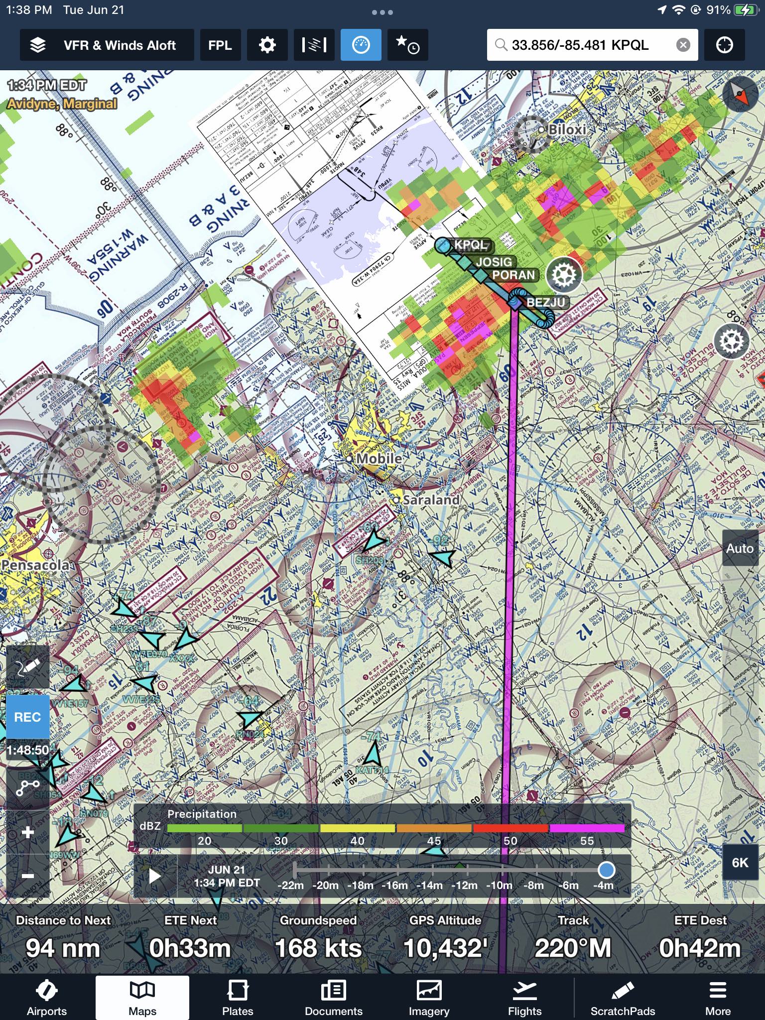
With an hour to go on our flight, the destination winds were reported calm and an approach to the south looked doable. As we got closer, the cells grew more intense right over the IAF for the RNAV 17 and it was clear that this wasn’t going to work. I started planning to fly south to get lined up with the north RNAV35 approach. Passing between the building cells north of our destination and the cell developing further east of us and Mobile Alabama was the idea.
Once within 30 minutes of our destination, the RNAV 35 option also fell out of favor as the storm covered the final approach path there as well. It began to appear that I might not actually be able to land until this storm clears. As an alternative, I looked for and found a small airport to the north I could use as a holding point on the ground if need be.
So now it was onto Plan C. I’d fly between the cells, just like I was going to use the RNAV 35 from the south. Only now I’d continue my descent to ensure I stayed out of the clouds and could see where the rain shaft and cells were. I noted that the cell over my destination was dissipating, as was evident from the anvil looking cloud top; the clearly intense rain shaft; and reports of extreme precipitation in front of me.
I called Mobile approach; asked if he could see anyone getting into KPQL. We discussed the plan I had in mind, including my plan to escape over the water if need be, and then come back to an airport to the north and hold on the ground. He thought it might work out well, and gave me a heading to follow with 65 nm to go. I thought it was so much fun developing a battle plan with the area controllers on my way in. I was loving it.
In between two extreme cells we went, heading south toward the coast as I descended to remain underneath the clouds with good visibility. Drop down below 4000’ and then 2000’. Once underneath, I realized that this was going to work! Level at 2000′ I was underneath in 6 miles visibility and cleared to the airport. I kept my speed up all the way as it looked like the cells were regenerating (they were, and would block this path in about 45 minutes). Flying past airports along the coast, I made a mental note to use each successive one as a new escape plan, should I get cut off before my destination. I had plenty of gas and plenty of ways to run away.
Pascagoula airport appeared dead ahead, and we landed without incident behind a helicopter. I was a bit high on final, but was able to grease the landing even with full flaps. We are here! Chris and Hayden appeared from the FBO to take care of my airplane, so I briefed both of them on the nose gear tow limits. I supervised the refueling, and chose to top off all tanks. In retrospect, I should have left the nacelle tanks empty for weight. It’s hot down here.
Follow up on technical issues: When I reached the hotel I fired off two emails. I notified Avidyne of the incident where I lost the sat signals and Lightspeed of the headset issue (the later to inquire about upgrading my headsets). Avidyne got right back to me with instructions for capturing logs, and Lightspeed as well looking for serial numbers.
Legends Hotel: Bev and I checked into the Legends hotel, with the expectation that cigarette smoke would be non-existent or at least at a minimum. The hotel was very nice, but the first room had smoke smell and someone had cheated. Our second room smelled great, so we were all set.
The Legends Hotel had apparently been a senior citizens home before Katrina. It was destroyed by the storm, with all the windows blown out front to back. Since then, the building was restored for use as a hotel with a 40’s and 50’s star theme (Sinatra, etc). I’d definitely stay here again. If you are as sensitive to smoke as I am, check the comments for the hotels in the area before you book.
I put a YouTube video out there for this trip that will give you an idea of how much fun we had going down and coming back. Admittedly, there are more fun family pix than flying pix, but we really had an incredibly good time that included flying; fishing; pools; gators; boating; live shows; little race cars; and a shrimp boil with a bunch of great folks.
We started our trip home on Friday, Jun 24 from Pascagoula airport. Before we left I met Tim who had set up the FBO and led the charge on improvements there. Tim gave us special attention, follow up on a great start that Christy, Hayden, and Chris gave us when we got here.
Hats off to Southern Sky Aviation who took amazing care of my wife; my airplane; and me. Great service at a fair price. Hangared while there. Everyone had a story to share and Bev and I love hearing them. It’s a new thing for me. Realizing how awesome people are right in front of me, and having time to listen. I had an unreasonably great time!!!!
We fired up the airplane when the tower opened at 8am. Even though I was at the runway end and waiting, four Cessna 172’s got off ahead of me. They departed one after another from a short intersection take-off and were out of there. I had learned from Tim that the string of Cessnas taking off in front of us were all fish spotters. They work for the omega fish oil company adjacent to the airport (I am an everyday customer since my eye surgery). These pilots work the boats first for a few years; then transition to flying in circles looking for fish. 6 months on. 6 months off. That’s what they want to do forever.
The Lightspeed headsets are both working normally again for the flight home. Go figure. The Avidyne IFD550 is also working fine, so it will be interesting to see where that goes too.
We climbed to 9,000′ initially and that put us right at a scattered cloud layer. Bumps. I then asked for 11,000′ and climbed up for that, accepting a 10-20kt headwind in trade. Bev and I have been using oxygen the whole time, so the altitude should be no problem. We were headed for Lee County, a fuel stop, and then lunch on the last leg home.
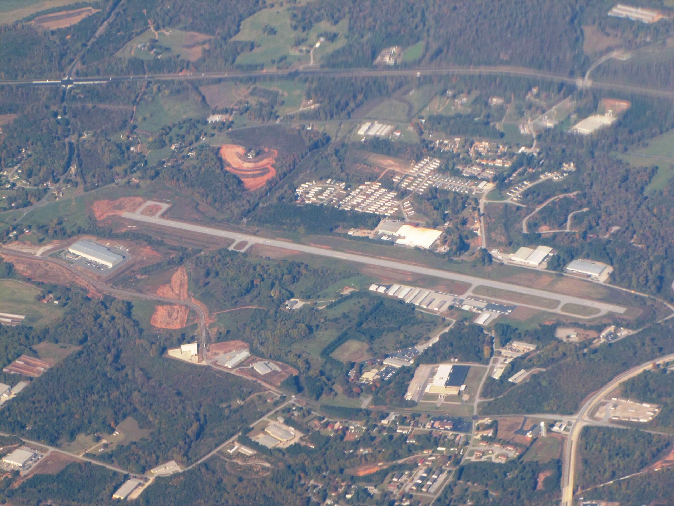
Landing at 0VG (Lee County, VA) we found an airport in between ridges. The view was spectacular and the airport looked like it had just been finished. Everything was new and no one was anywhere to be seen. One single airplane on the ramp was all we saw there.
Unable to get a clearance out of 0VG! Well sir. I started up, taxied out, and called the clearance delivery number to pick up my clearance for the last leg home. The operator told me I was number two for getting a departure clearance, and I waited on hold for 5 minutes. He came back and said I’d need to call another controller (London Control). I called that number and they flatly refused to give me a clearance because it was out of their area. I called back to the first number and he said he couldn’t help me. WTF!
At this point I’d been idling on a hot ramp for 10 minutes and told him thanks. I’d pick it up in the air. Departing via the obstacle departure procedures, I climbed over the airport to 3200′ and procedure direct MRB (Martin State). Passing 4000′ I was finally able to reach a controller to pick up my clearance.
Had the conditions been IFR, I would have pressed the issue further to get out of there. Beautiful airport in the middle of nowhere though.
Wrapping things up: Bev and I landed and put the airplane away. I went back the next day and followed Avidyne’s instructions to download detailed logs from my navigator. I’ll wait to hear back from them – suspecting that a new GPS antenna may be in my future. I also captured the Lightspeed serial numbers, and am considering upgrading those as well.
In my hangar the next day, I sipped a cold beer and stared at my airplane sitting there. I’m so very fortunate to be right here, right now, enjoying the benefits of a life of hard work. Hard work that I very much enjoyed.
Fly safe and be well, my friends.
Frank