
It has been quite a month of flying along the east coast for me. It began with a flight to Columbia, SC with three passengers going to a college initiation. They had to be there on a Wednesday morning at 8am, but the weather forecast reduced the probability that I’d be able to get them there with any certainty. I decided to leave on Monday July 6th, one day earlier than planned.
July 6th Flight South: The weather on Monday morning looked as bleak as the forecast was for the next day. I filed almost a direct route with a 2 hour flight time, fully expecting Philly to give me whatever they thought would work. They ended up giving me a routing directly west that would require over 4 hours in the air. I accepted it just to get off the ground, knowing that I’d either be stopping somewhere for fuel, or finding a way through with other controllers in a less busy area.
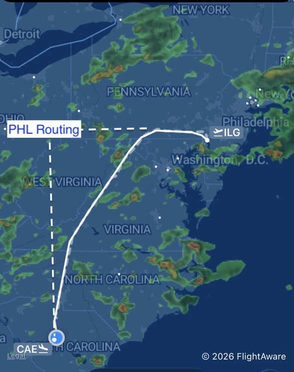
The dotted line in the image at left shows the approximate route Philly gave me out of Wilmington. The solid line shows the route that we actually flew by looking out the window, finding holes for safe passage, and negotiating with controllers. Jeff and I were continuously evaluating what we saw against the Sirius Weather, and then discussing that with whatever controller were were talking to at the time.
All three inputs were weighed continuously, and an escape plan was developed at each stage. The storm cells were widely scattered and intense. Clouds and development were present throughout the region, and many of the developing cells did not have enough water yet to show up on the radar image at left.
This is exhilarating work, and the best teamwork you’ll find. Air Traffic Controllers along the east coast are simply the best. In this case, we made the suggestions, they evaluated, and together we made it work. Our flight lasted maybe 2.5 hours and encountered no appreciable turbulence on a volatile summer day.
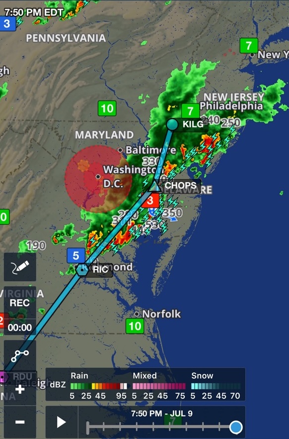
July 10th Flight North: We were to leave late on the 9th to take the passengers home to Wilmington. I was at the airport and ready to go, looking at actual weather and not a forecast. What I saw was a slow moving line with copious amounts of lightning that would block us on the way home.
What isn’t shown here is that further development to the west of our route would persist and come in behind it. Significant hail was forecast by these storms, and if I could only get part way home, I’d have that beautiful Cheyenne sitting out on the ramp while it came through.
I informed the passengers that I thought staying in Columbia another day would be the best solution. Norfolk was possible, but the accommodations here were known and better. Additionally, a morning departure would allow us to avoid the heat of the day and the majority of expected thunderstorms.
Our trip home the next day was a smooth ride in clear skies. The three day trip we had planned on turned into 5 days. In retrospect – I like all of the decisions I made to get us there and back safely, and would do the same thing all over again.
July 13th Maintenance Flight: We are working on a Cheyenne pitch trim issue with Lancaster Avionics, so I flew the Cheyenne up to Lancaster solo. Jeff picked me up in his C150 and we flew that back to Wilmington.
July 16th Canadian Wildfires: I was flying again this day in my Twin Comanche to have the same avionics shop change my altitude encoder from an older altimeter to the newer Aspen. I also asked for the IFD550 to be updated while it was there as well. This would allow me to bring the Cheyenne home and avoid further travel logistics for Jeff, at least for today.
I filed IFR for the ride up, but both airports (ILG and LNS) were reporting VFR with good visibility. I chose to go VFR but as soon as I climbed through 1500′ I was glad that I had an instrument rating. Because of the Canadian smoke, the entire world turned a light tan and visibility was barely VFR. I landed without incident and taxied to the avionics shop. After securing my machine, I exchanged information on both airplanes with the experts there before I picked up the keys for the Cheyenne.
For the trip home I both filed IFR and flew the plan out of Lancaster to Wilmington. The route home was most definitely IFR in thick brown smoke. I tried to do some flight testing on the autopilot anyway, but began to fall behind the airplane when the controllers gave me route changes and vectors to an approach in quick succession. I clicked off the autopilot and manually flew the RNAV 27 into Wilmington with about 2nm of slant-range visibility. Flight testing the Cheyenne would have to wait.
July 20th Cheyenne Test Flight: I had been scheduled to pick up my airplane on Friday the 17th, but the smoke was still bad and the ceilings below minimums. I deferred until the following Monday, and would retrieve my airplane after flight testing the Cheyenne. For this test, I wanted to confirm that the completed work didn’t take away any capability for an upcoming trip, and evaluate the pitch trim condition more thoroughly. Jeff and I were able to do this flight very quickly, and returned with the information we needed before heading back to the avionics shop in Lancaster.
Jeff and I put the Cheyenne away and jumped in his C172 for the flight north. Once again we taxied to the avionics shop where we briefed again on two airplanes. We made a new testing plan for the Cheyenne and shared new information Jeff had uncovered before Jeff and I flew our airplanes back home.
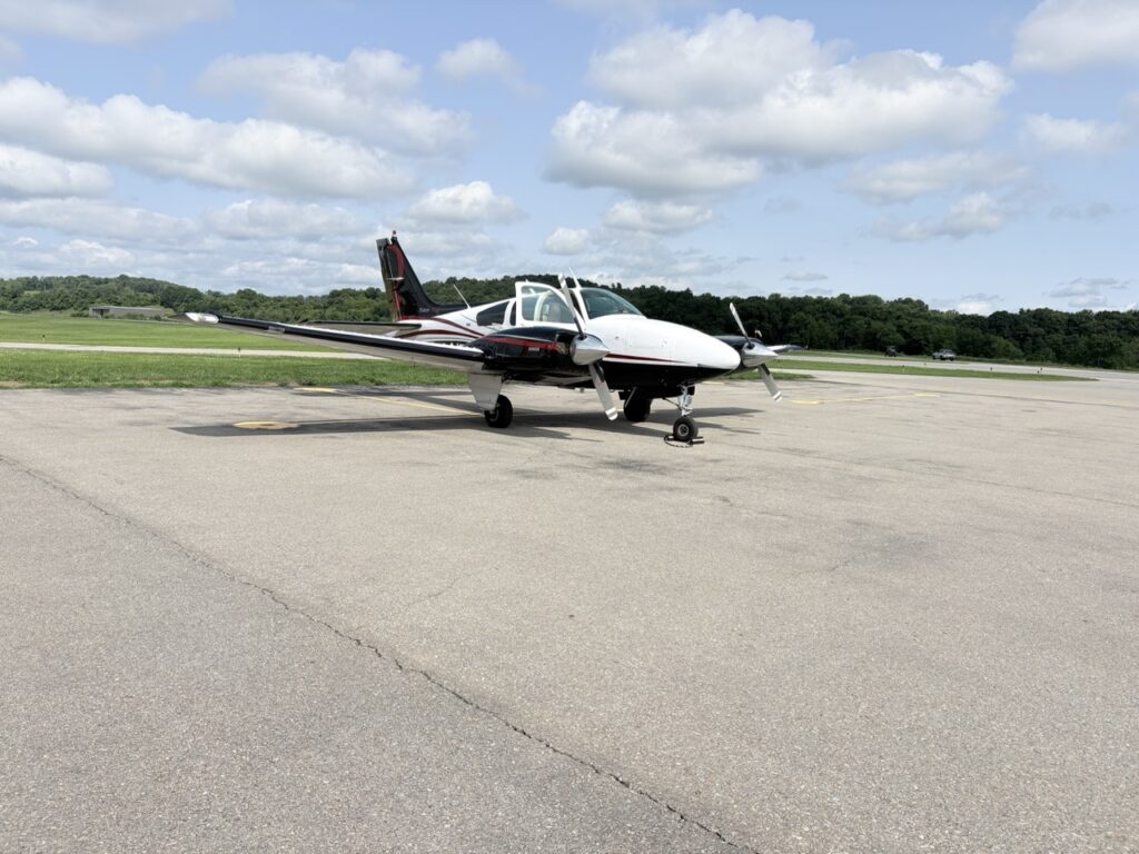
July 22th Baron Flying: Brian is a copilot that flies with me often and has a very nice Baron 55. I flew with Brian out to Washington County in Western Pennsylvania so that he could get IFR time with an instructor in his airplane. Brian is working towards a commercial certificate, and this round trip cross country is a requirement.
July 30th Relocation Mission: The mission today involved flying to Youngstown, Ohio to pick up 3 adults and 2 dogs. From there we’d fly to Augusta for fuel, and then on to Marco Island, FL.
We got a late start out of Wilmington and a bit of a headwind, so the ride south began later than planned. The route had clear skies all the way – that is until we reached the Florida border.
Leaving Ohio we could look ahead and see strong thunderstorms completing blocking our access to the peninsula. My plan was to get to Augusta and re-evaluate the last leg of the trip.
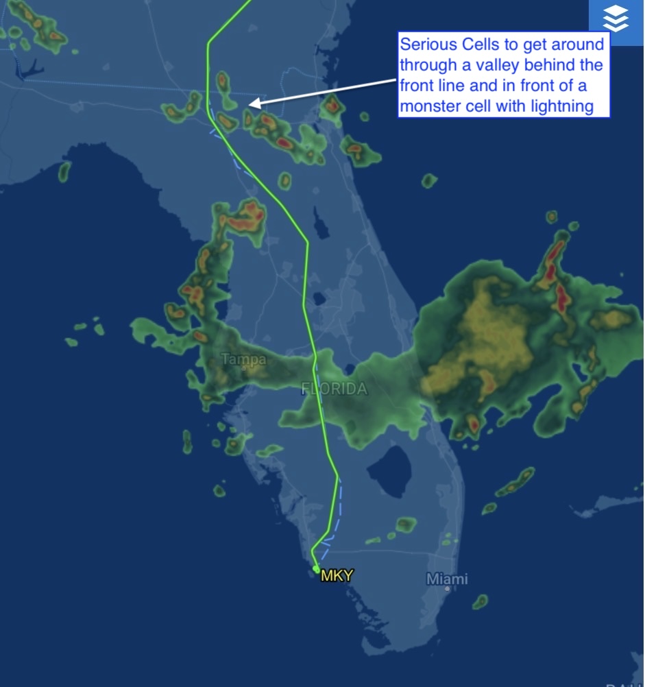
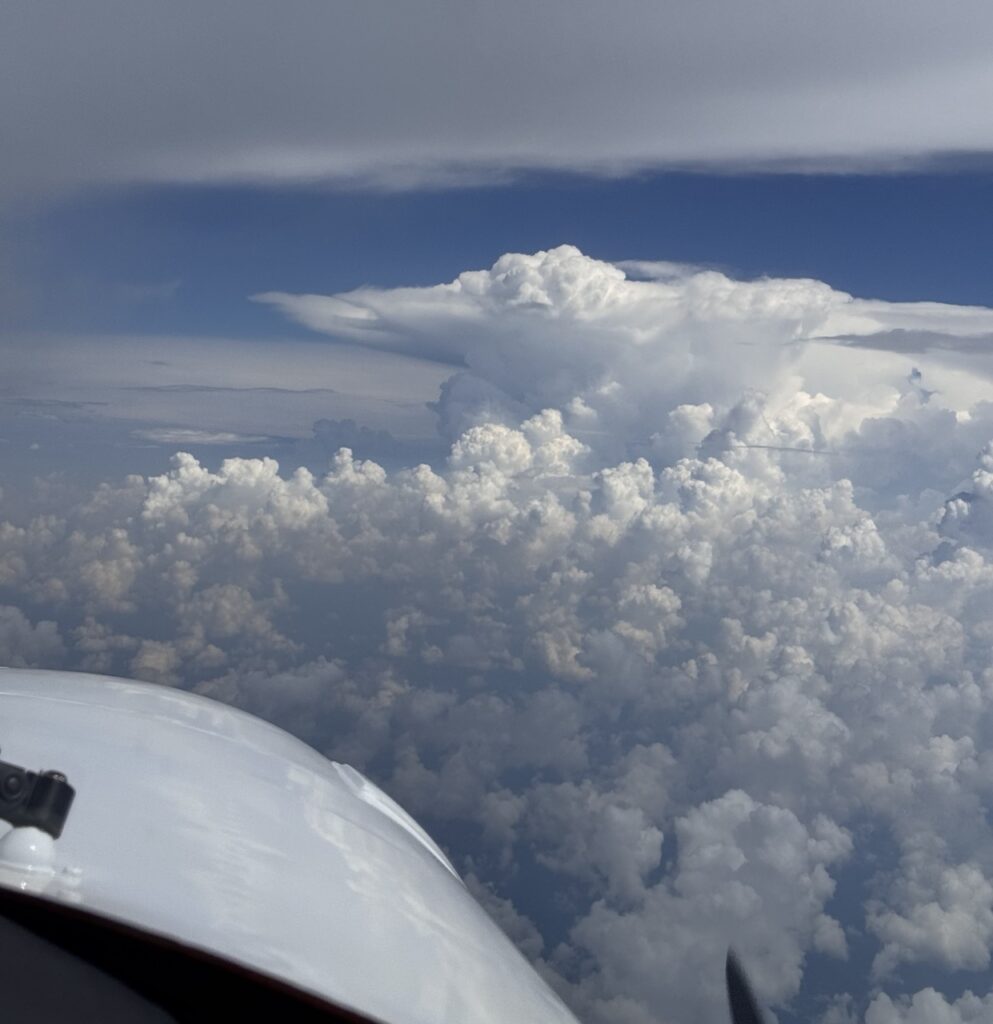
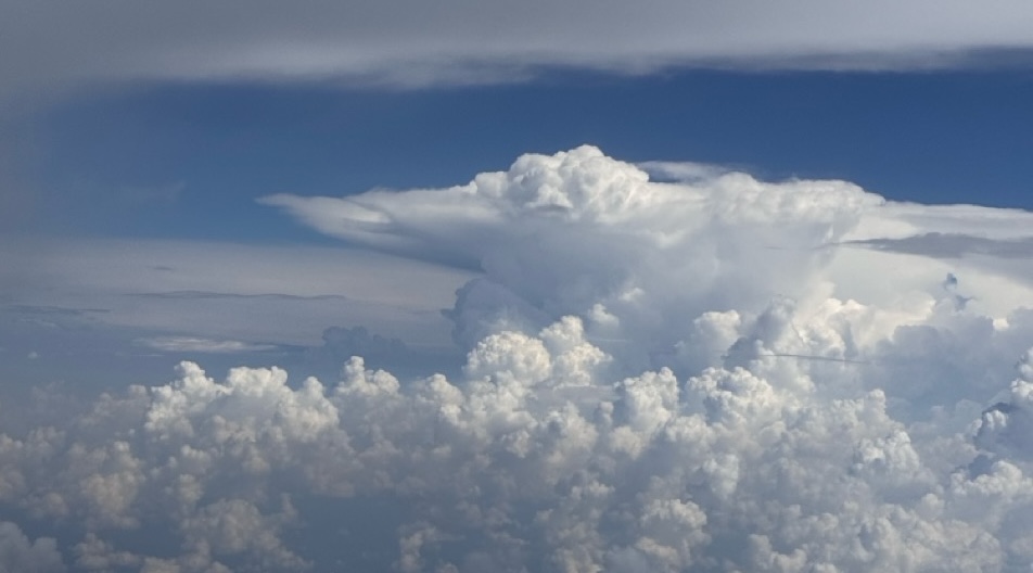
The picture at left was taken by Brian at 23,000′. No way I could outclimb these monsters, but we worked together and with the air traffic controller to plot a safe course through the maze.
I had been leaning toward a path that would take us 30nm out over the Gulf of America and west of all the storms. Tampa was still getting hammered. One timely suggestion from a controller got both Brian and I looking at our second option – squeezing through two monster cells that lay ahead and flying down the center of Florida.
We could see traffic following the same path and the route that way was ominous looking, but smooth and clear of imminent danger.
I am ending the month in a hotel down in Naples, with a flight plan that will take us home tomorrow morning, Monday, August 3rd. Three legs to home in rain and low clouds, and I’m sure our share of new storms.
Fly safe!
Frank